Helicopter Patrols
Ausgrid Helicopter Patrol

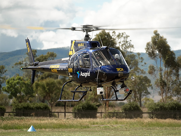
As part of our bushfire prevention program we use helicopters to inspect powerlines, poles and other equipment in bushfire-prone areas.

Helicopters enable us to view and assess our network from above using light detection and ranging (LiDAR) scanning and high resolution photography to identify poles, equipment and vegetation that may present a future bushfire risk.

When do we carry out the patrols?

Our crews will typically be in the air no earlier than 1 hour after sunrise and no later than 1 hour before sunset (weather permitting). The helicopters fly at speeds between 90 and 170 km/h and between 100 to 300 metres above the ground. 

The LiDAR scanner sends and records 300,000 pulses every second to create a three-dimensional representation of the Ausgrid network and surrounding environment.

Property owners should consider securing livestock during the patrols as helicopters need to fly low at times, which may startle livestock in rural areas.

What are we capturing?

Ausgrid uses helicopters to obtain images of our assets from the air. Camera equipment used on helicopters are not used to capture images of the public or personal information.

The helicopter crews use LiDAR (laser imaging equipment and high resolution photography) to identify vegetation growing close to powerlines and pole top defects. The LiDAR scanner sends and records 300,000 pulses every second to create a three-dimensional representation of the Ausgrid network and surrounding environment. This informs where we send ground crews to conduct maintenance and upgrade work ahead of the next summer period. Find out more about the Bushfire Prevention Program.

Helicopter network inspection flight schedules

Ausgrid will be using helicopters to support the bushfire maintenance checks across the electricity network between 2 April 2024 and 7 June 2024. 
Click a location on the maps below for more information on the helicopter flight schedules in your area.